|
|
|
| Home |
USDA Forest Service, Pacific Northwest Research Station |
|
|
|
| Home |
USDA Forest Service, Pacific Northwest Research Station |
|
EnVision
brochure (pdf format)
Send comments to
EnVision's developer, Bob McGaughey
|
Few people--even forestry
professionals--can look at a data table describing the
trees in a timber stand data and visualize what it tells
them. What if they could look at pictures, instead of
numbers? It is even harder to visualize how
that timber stand or landscape would look in the future if
it were managed in different ways. Wouldn't it be
nice if they could see how it might look in the future
before they acted?
Computer-based landscape simulations are a valuable tool for previewing the visual impacts of land use decisions. The simulations can:
EnVision Goals
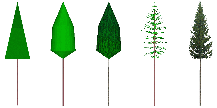
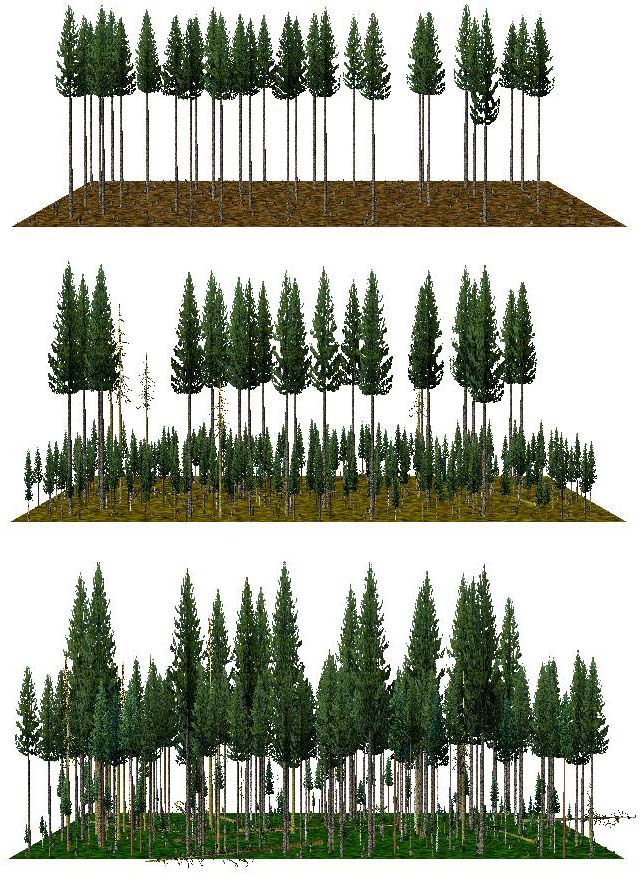
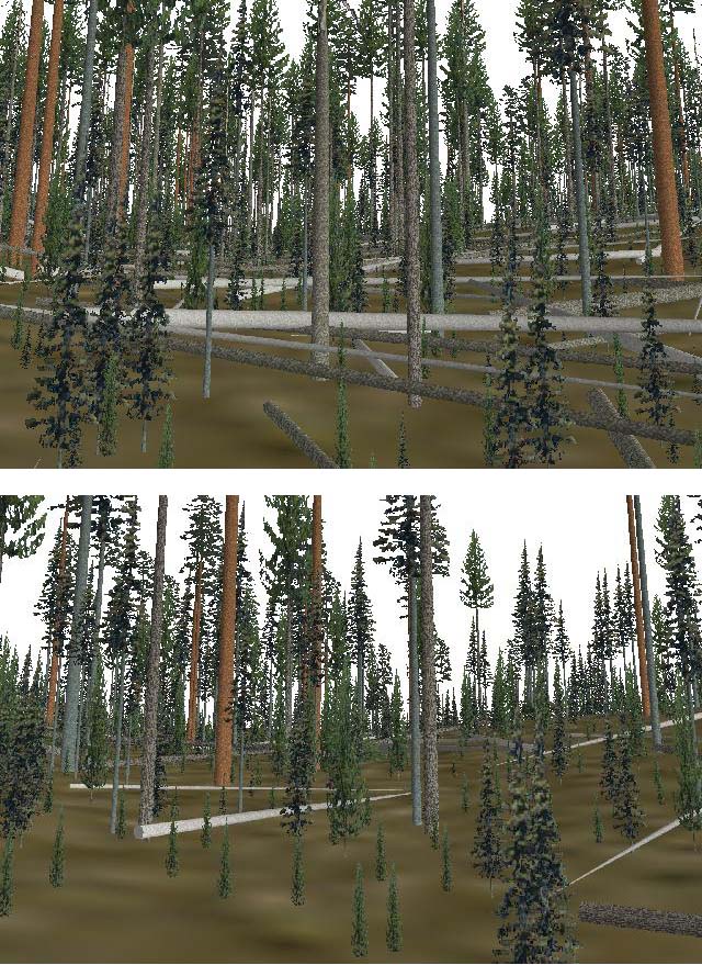
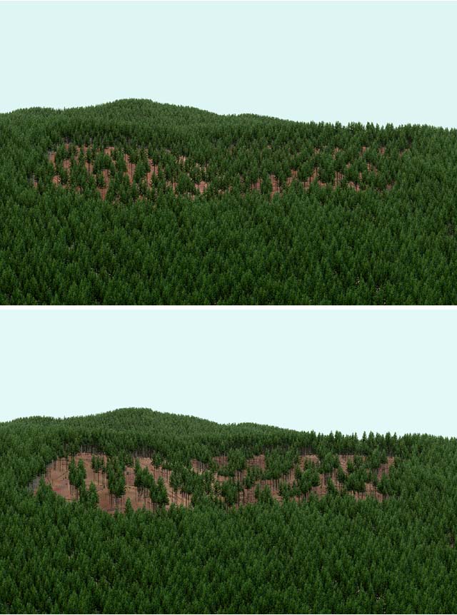
EnVision Helps Visualize and Communicate Changes and ChoicesDeveloped by researchers at the Pacific Northwest Research Station, EnVision-the Environmental Visualization System-is a sophisticated computer simulation tool for illustrating stand- and landscape-scale projects.Foresters, biologists, and others charged with selecting stands for treatment and designing silvicultural prescriptions often find it difficult to imagine the complex interactions that occur across landscapes. Traditional work methods have not always provided enough information to fully evaluate the cumulative impact of an array of management choices. EnVision can help land managers and others understand the effect of proposed treatment designs as well as help answer questions such as How well does the design meet the overall goals? How does the proposed design affect different resource values? Forest managers of both public and private lands face a challenge when planning any kind of management activity: Will the public accept the way the landscape will look after proposed changes are made? How can they establish a dialogue about what the changes might look like on the landscape through time? EnVision shows particular promise for enhancing public communication. Key Attributes of EnVisionEnVision is a full-featured image-generating system for stand- and landscape-scale projects. It builds on many of the concepts used to develop preceding visualization systems, such as Vantage Point, Stand Visualization System (SVS), and UVIEW. EnVision is based on a digital terrain model that defines the ground surface. Color and texture maps show ground surface characteristics and can create "synthetic aerial photos" or highlight areas of interest, such as roads, streams, or observation points. The program uses individual tree lists and can expand stand tables into individual trees within polygons. Three-dimensional objects range from simple "sticks" to photo-realistic icons representing trees and other vegetation.
Examples
|
This page was last updated on June 11, 2018 by Bob McGaughey